High-flying art: Using technology to pre-visualize drone images
Drone photographers J.P and Mike Andrews of Abstract Aerial Art photographers describe how they use Google Earth to find good drone compositions
• February 2020 issue
The best drone artists steal their ideas right from satellite imagery—and improve on them. That’s the strategy of artists J.P. and Mike Andrews, two U.K.-born brothers known for their incredible aerial images. They’re some of the world’s best drone photographers, but the time they spend flying drones is minuscule compared to the time they spend researching their shots.
The two brothers will drive for hours to remote corners of the earth to photograph bizarre anomalies in the landscape. While one is driving, the other is browsing satellite images, generally from Google Earth or Google Maps. Once they find a spot on the map that looks interesting, they recreate it with a drone. The Google Earth program allows users to explore the globe by entering addresses or coordinates or simply by moving a curser. This allows the Andrews brothers to, in effect, pre-visualize their drone shots.
“We go as far as composing the same shot we’re about to take within Google Earth,” Mike says.
Some drone photographers will go to a spot they think could be photogenic, like a park or beach, and fly their drones around until they’ve spotted something interesting. But not the Andrews brothers. They already know what they’re looking for before they’ve even arrived.
“It saves us a lot of time and prevents wasted trips,” JP said. “We already have the image before we’ve actually taken it.”
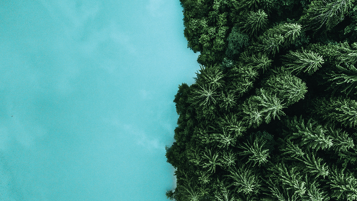
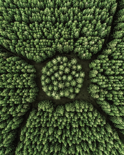
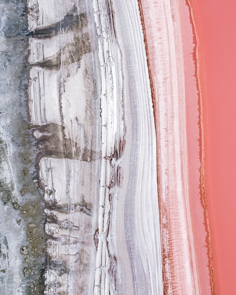
What kind of landscapes make the best drone subjects? Anything that catches his eye, says JP. “Interesting patterns, unique textures—those typically make a good shot. Look for symmetry or something that doesn’t look natural, like it’s not supposed to be there.”
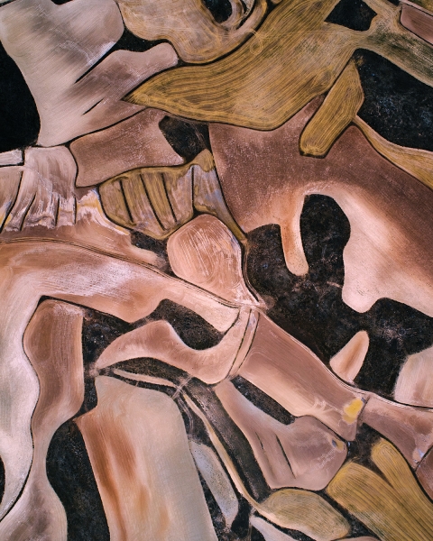
Some of the patterns are by human construction; others are all natural.
The Andrews’ favorite spots are places like rail yards and garbage dumps—places most people would consider eyesores. Seemingly mundane parking lots and city blocks are places most people don’t pay attention to. But when photographed by the Andrews brothers, they’re infused with elegance.
“Our favorite things are the things most people call ugly or useless,” says Mike. “People drive by these places and have no idea what it looks like from the air. But from the air, they’re beautiful and bizarre.”
Sometimes the Andrews improve their composition by adding props, typically to infuse a pop of color or to create perspective. A human resting on a long dock shows scale. A yellow umbrella amid a sea of red flowers builds contrast.
“People like perspective, so we’re building that in more and more,” J.P. says. “We’re adding in cars or umbrellas to help you realize how high the drone is. When you have something your eye recognizes, you can better understand what you’re looking at.”
The brothers’ penchant for offbeat photo locations has another perk: fewer run-ins with the law. Many drone photographers have lamented crackdowns on drone flying near popular locations. In the United States, it’s illegal to take off and land drones in any national park without permission, making it nearly impossible for drone photographers to fly over Yosemite’s Half Dome, South Dakota’s Mount Rushmore, or even San Francisco’s Golden Gate Bridge. Drones are banned from flying near popular international tourist attractions, too, like the Eiffel Tower. Private property owners can ban drones from taking off or landing at their own discretion, meaning no drones at many golf courses, lakes, or college campuses.
But that’s not a problem for the Andrews brothers.
“We rarely go to the famous spots, and the majority of our shots are not taken in well-known locations at all,” J.P. says. “Everyone has a camera nowadays, which means those photos, like the Eiffel Tower, have been done a million times. There’s a lot more out there than just the big landmarks. Shoot something that’s different. There’s so much beauty out there.”
Sally French (aka the Drone Girl) is a world-renowned expert on drones.
RELATED: See more of the Andrews' images.
 View Gallery
